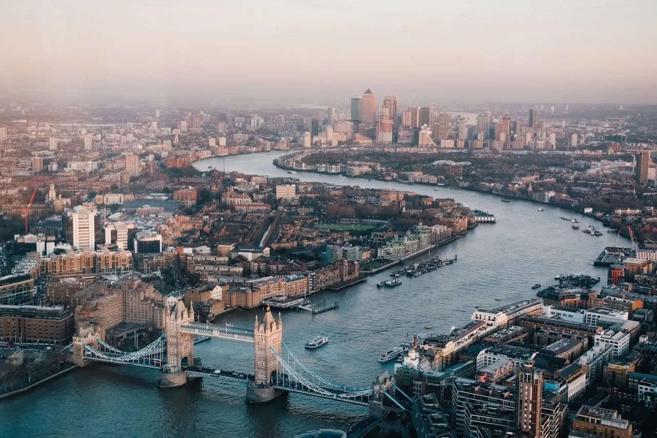
High-Accuracy Drone Surveys Across London
Operating with enterprise-grade **DJI Matrice 4E RTK** platforms, we deliver survey-grade topographical data, 3D point clouds, and measured building scans. Fully CAA-compliant, insured, and ready to mobilise at short notice.
±15mm
Horizontal Accuracy
CAA
Operational Auth
£5m
Public Liability
DJI Matrice 350 RTK / M4E
Why Engineers & Developers Choose London Aerial Surveys
We bridges the gap between commercial drone operations and land surveying standards, delivering raw engineering files aligned to your site grids.
CAA Operational Authorisation
Fully certified by the Civil Aviation Authority for safe drone operations in complex, congested urban airspace across Greater London.
Enterprise DJI Matrice 4E
Deploying survey-grade RTK telemetry receivers and mechanical shutters to eliminate distortion, ensuring millimetre-level precision.
Rapid Mobilisation
Available at short notice with local pilots stationed across London, ready to deploy to your development site within 24 to 48 hours.
Engineering-Grade Data
We don't deliver pretty pictures. We export raw geo-referenced data files (.DWG, .LAS, .GeoTIFF) ready for AutoCAD, GIS, and BIM packages.
Technical Drone Surveying Services
We focus strictly on surveying and geospatial data capture. Every flight produces scale-accurate maps, 3D measurements, or engineering models.
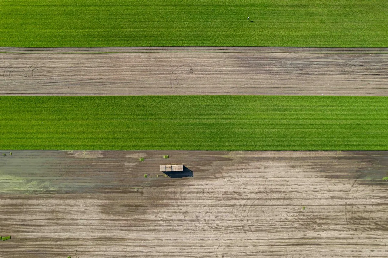
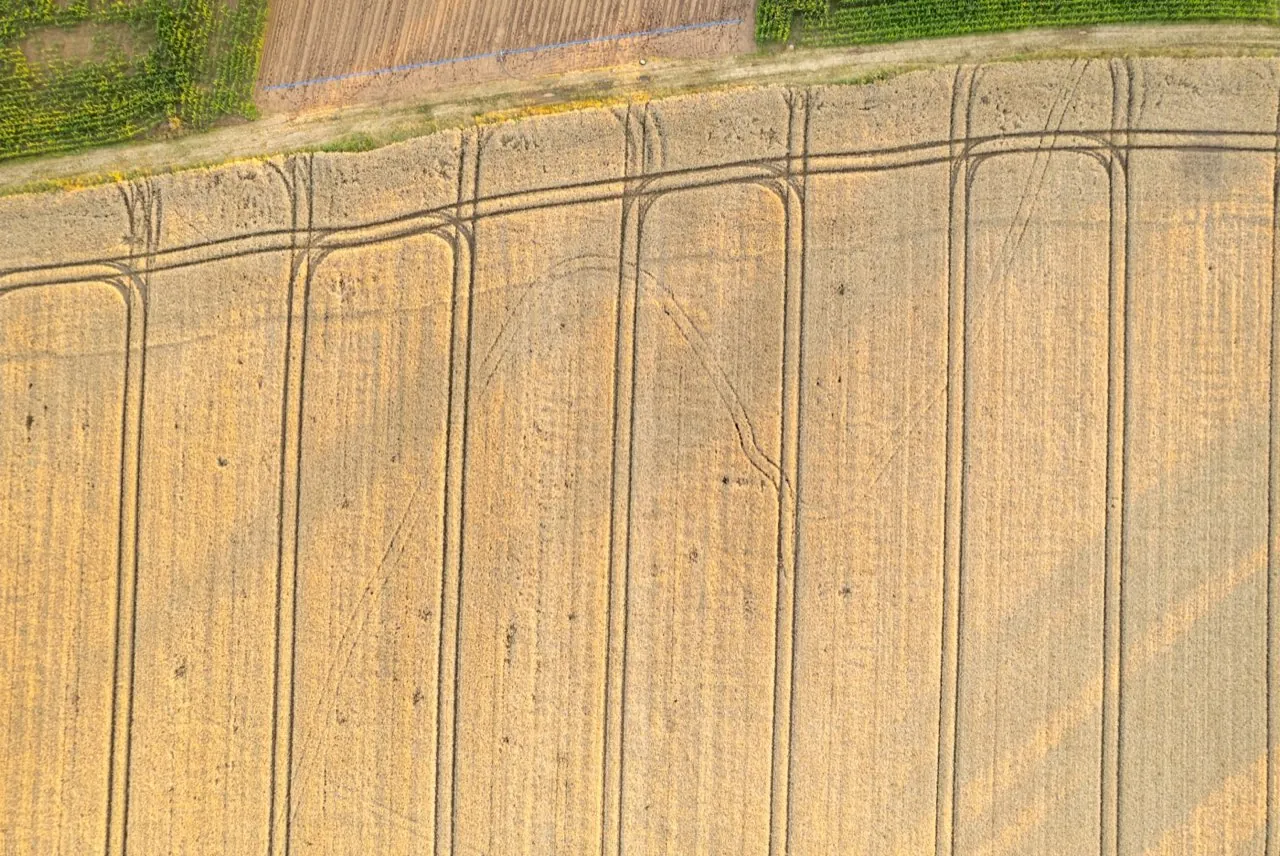
Drone Topographical Surveys
High-accuracy, rapid topographic data capture for greenfield, brownfield, and urban development projects across London.
- 2D/3D CAD Drawing Files (.DWG / .DXF format)
- Digital Land Surface Contours at 100mm / 250mm intervals
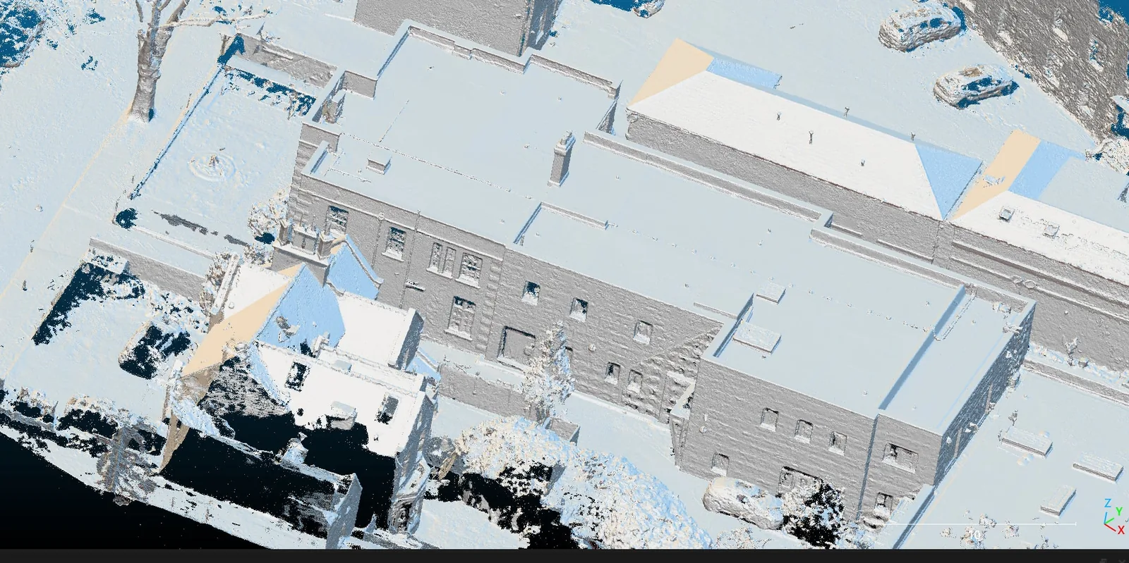
Digital Terrain & Surface Models
Precision bare-earth DTMs and fully-featured DSMs for flood risk assessment, drainage engineering, and terrain analysis.
- Bare-Earth Digital Terrain Model (DTM) in GeoTIFF / ESRI Grid format
- Digital Surface Model (DSM) representing absolute top surface heights
Photogrammetry 2D & 3D Mapping
High-resolution, scale-accurate photogrammetric reconstructions mapping complex development sites and land parcels.
- Ultra-high resolution Orthomosaic site maps (sub-centimetre GSD)
- Fully textured 3D Meshes (.OBJ / .FBX / .glTF format)
Orthomosaic Mapping
Geo-referenced, ortho-rectified high-resolution map mosaics for site assessment, planning applications, and GIS layers.
- Geotagged GeoTIFF format maps (with coordinate reference systems embedded)
- Compressed Web Tiles (MBTiles or KMS folders) for web mapping tools
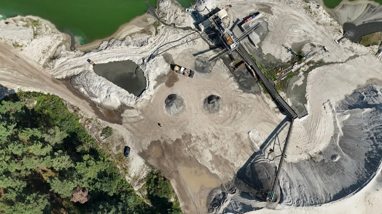
Stockpile & Volume Surveys
Fast, safe, and highly accurate volumetric measurements of bulk materials, aggregates, and excavations.
- Volumetric Survey Report (PDF detailing stockpile volume, area, and heights)
- Cut-and-Fill contour maps showing height variances
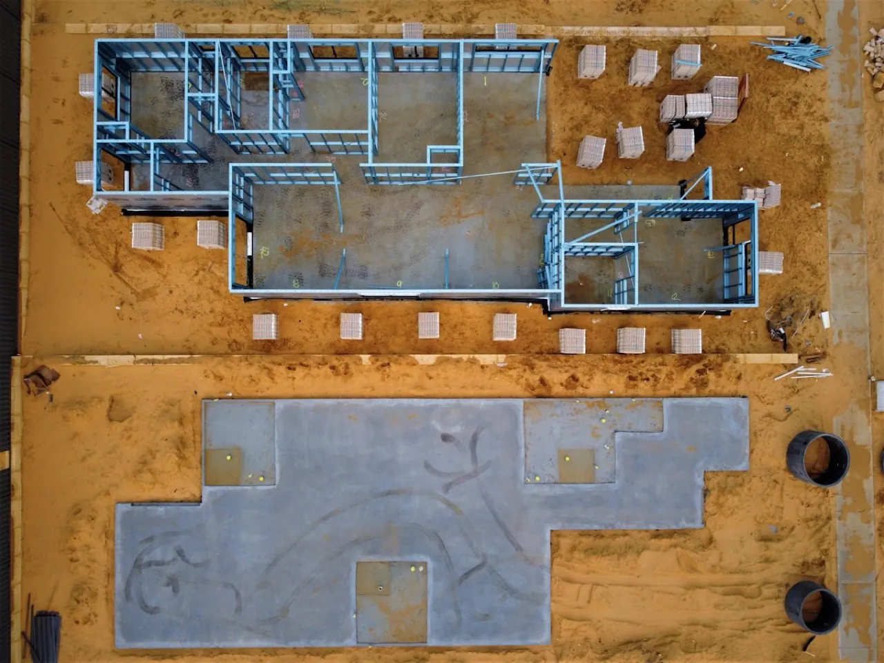
Pre-Construction Site Surveys
Comprehensive baseline data capture to document existing site conditions, levels, and neighbouring assets before works begin.
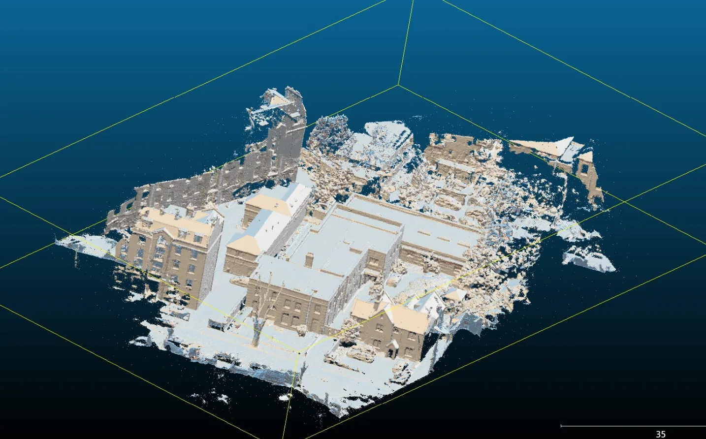
- Complete 3D baseline site models and point clouds
- High-resolution geo-referenced site overview maps
Our 4-Step Technical Workflow
A modern, safety-first drone survey requires more than pushing a button. We enforce a rigorous engineering process to verify absolute spatial accuracy.
Flight Planning & Airspace Clearance
We conduct meticulous pre-flight risk assessments, log digital flight notifications with NATS, and acquire necessary CAA authorizations for restricted zones.
Ground Control Station (GCS) Setup
Using Trimble survey-grade GNSS rovers, we establish physical Ground Control Points (GCPs) and checkpoints to anchor the model to British National Grid (OSGB36).
Systematic UAV Data Capture
We deploy the enterprise-grade DJI Matrice 4E platform, flying autonomous grid paths with optimized vertical and lateral overlaps to capture raw orthographic telemetry.
Data Stitching & Quality Assurance
Our processing team stitches telemetry in photogrammetry engines, aligns it to GCP constraints, and delivers CAD-ready files (.DWG, Point Clouds, Orthomosaics).
Operating Across All London Boroughs & Postcodes
Our team is based locally and mobilises rapidly. We possess operational authorizations that permit flights in congested areas across every London borough, including Central London airspace.
Quick Access: Top Target Locations
Below are quick links to drone surveying services in key districts of the capital.
Service × Location Examples
Frequently Asked Questions
General guidelines regarding drone surveying regulations, safety, and project parameters in London.
Is it legal to fly survey drones in central London airspace?
Yes. However, the majority of London falls within restricted airspace (such as Heathrow or London City airport CTRs) and congested urban environments. As a professional commercial operator holding CAA Operational Authorisation, we handle the entire coordination process: securing NATS flight approvals, notifying local police, and setting up strict safety cordons.
What happens if the weather is poor on the scheduled survey date?
Safety is our highest priority. We do not fly in high winds (above 22 knots) or active rain to protect our enterprise payloads and maintain data quality. If a flight is delayed due to weather, we reschedule for the next clear window at no additional cost to you.
How do you ensure the absolute accuracy of the survey data?
While we use RTK-enabled drone telemetry, we do not rely on drone GPS alone. We place physical Ground Control Points (GCPs) across the site before the flight and survey them using Trimble survey-grade GNSS base stations. These points are used in the photogrammetry engine to anchor and verify the model, guaranteeing millimetre-level absolute spatial accuracy.